


 Leeds
Leeds Doncaster
 Sheffield
 Bradford
 Hull
Hull Halifax
 Sunderland
 Newcastle
 Middlesborough
 Yorkshire Moors
 Teesside
 Cumbria
 Harrogate
 York
York Yorkshire Dales
 Northumberland
 Goole
Goole Carlisle
 Keswick
 Kendal
 Barrow-in-Furness
 Lancaster
 Blackpool
 Morecambe
 Southport
 Liverpool
 Wigan
Wigan Manchester
 Blackburn
 Burnley
 Forest of Bowland
 Oldham
 Chester
 Stockport
 Peak District
 Skipton
 Crewe
Crewe Rotherham
 Stoke
Stoke Driffield


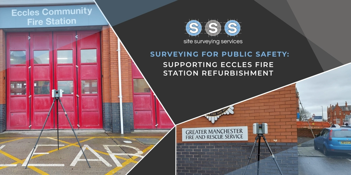
Surveying Services in Carlisle
Citadel
For this project at The Citadel in Carlisle, we worked collaboratively with another surveying company to deliver comprehensive surveying services.
The Citadel, located on English Street in Carlisle, Cumbria, is a historically significant site featuring two Grade I listed buildings: the Nisi Prius Courthouse and the former Crown Court. The project aimed to assist with the planning and potential conversion of these historic structures into a campus for the University of Cumbria.
Our team was responsible for producing detailed, full-colour scans of the buildings, capturing the intricate architectural details and current conditions of these historic structures. Using advanced laser scanning technology, we ensured that every element of the buildings’ exteriors and interiors was meticulously documented. This high-resolution, colour-accurate data was crucial for informing the conversion plans while preserving the historical integrity of the site.
Concurrently, our surveying colleagues utilised Unmanned Aerial Vehicles (UAVs) to perform aerial surveys of The Citadel. The aerial data provided a comprehensive view of the site’s layout and surrounding environment, complementing the detailed ground-level scans and contributing to a holistic understanding of the site.
To achieve the highest possible accuracy, we implemented a controlled traverse around The Citadel buildings using a Leica Total Station (TS). By establishing several control links, we created a robust and precise control network based on the Ordnance Survey National Grid (OSTN). This network was critical for ensuring the accuracy and consistency of all measurements taken during the project.
Additionally, we used black and white checkerboard targets scattered strategically around the site as reference points for the scanner. These targets facilitated precise alignment and integration of the various scans, ensuring that the resulting data was coherent and reliable.
The collaborative effort between our team and our surveying colleagues enabled the production of a comprehensive and highly accurate dataset. This dataset is invaluable for the University of Cumbria’s planning and development team, providing detailed insights necessary for the thoughtful and respectful conversion of The Citadel into a modern educational campus while preserving its historical essence. This project exemplified our commitment to precision, collaboration, and respect for heritage in our surveying practices.
Client details
Tritech Ltd
service provided
Laser Scanning and Pointcloud Production
Project timeline
10 days onsite approx. 11 days in the office
